Help MNHO Survey Seaweeds on Nine Islands in the Penobscot Bay Area
Your gift by December 15th (or participation in MNHO’s online seaweed art auction from November 15th to December 1st) will help raise $9,000 to cover expenses to complete seaweed surveys on nine islands in the greater Penobscot Bay area.


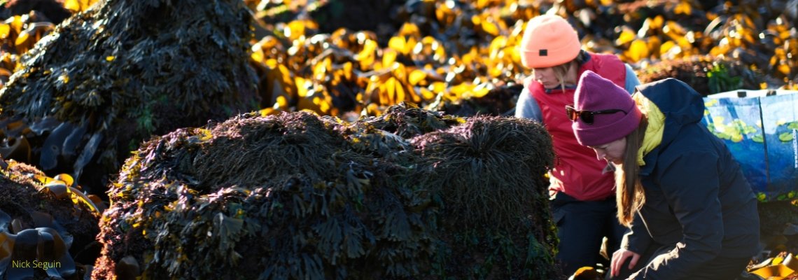
MNHO has been working hard on a Seaweeds of Maine field guide since 2021, and we are delighted to share that we are on track for publication in 2028! The surveys required to create this field guide have produced significant discoveries, including over a dozen species new to Maine, and brought to our attention an area of significant ecological interest that may help us understand how seaweed diversity will change along the Maine coast over the next several decades.
Here is what’s going on. Our seaweed surveys have indicated that Penobscot Bay is a transition area between two ecologically distinct regions: the southern Maine coast, where recent surveys have shown major shifts in species composition and abundance, along with the presence of invasive species, and the Downeast coast, which has remained largely unchanged compared with historic records. Understanding what is happening in this transition zone may help us determine whether the changes seen farther south are likely to reach the Downeast coast.
To assess these changes, we plan to repeat the surveys of nine islands in the Penobscot Bay area conducted in the late 80s and early 90s by Dr. Arthur Mathieson and his colleagues. Comparing the historic and new surveys will show how native and invasive seaweed species composition has changed in this region over the past three decades and provide baseline data to inform conservation efforts, policy reform, and expand scientific knowledge.
How to support this project
Transportation to these remote survey sites is expensive. Your gift by December 15th (or participation in MNHO’s online seaweed art auction from November 15th to December 1st) will help raise $9,000 to cover expenses to complete seaweed surveys on these nine islands.
Project Details
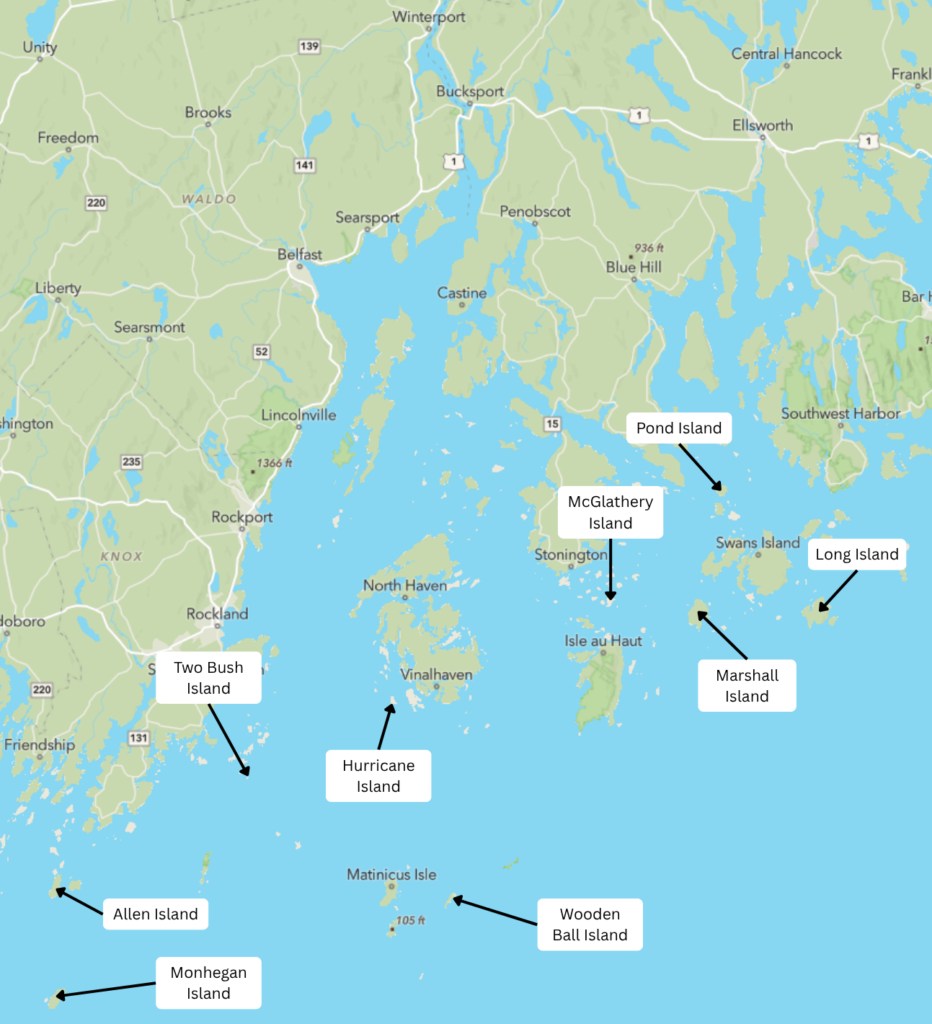
Penobscot Bay is a dynamic marine zone where the influence of the cold-water Labrador Current gives way to the warmer waters of the western Gulf of Maine, and fresh water from the Penobscot River creates gradients in temperature and salinity. Combined with its numerous islands and channels, these influences create a variety of marine environments. Many seaweed species are strongly affected by changes in temperature, salinity, nutrient levels, and wave exposure, making the greater Penobscot Bay region an exceptional setting for understanding how native and invasive seaweed species have shifted and whether further changes may be expected along the Downeast coast.
From 1985 to 1994, Dr. Arthur Mathieson and his colleagues from the University of New Hampshire conducted a baseline seaweed inventory in the greater Penobscot Bay region, surveying the following nine offshore islands: Allen Island, Hurricane Island, Long Island (Frenchboro), Marshall Island, McGlathery Island, Monhegan Island, Pond Island, Two Bush Island, and Wooden Ball Island. With this baseline data, we have the opportunity to repeat Mathieson’s surveys and document and quantify changes in this area’s seaweed flora over the past three decades. In addition to these general surveys, we will establish standardized, GPS-referenced monitoring areas on each island to provide a permanent framework for future inventories and add several nearshore monitoring sites in areas that are likely to be hotspots for change, such as major ports and confluences.
Project Leads


Stay Connected
Follow the progress of this project through our newsletter or on social media
Tools & Resources

Seaweed Map
Interactive map to explore the distribution of seaweed species in Maine.
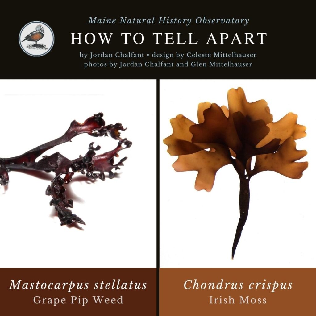
Seaweed Mini-guides
Free mini-guides for how to tell apart seaweed species.

Free download of Seaweeds of Maine mini-guide
A proof of concept for the upcoming full guide.

Seaweed Database
Database of seaweed references, vouchers, and observations in Maine.


